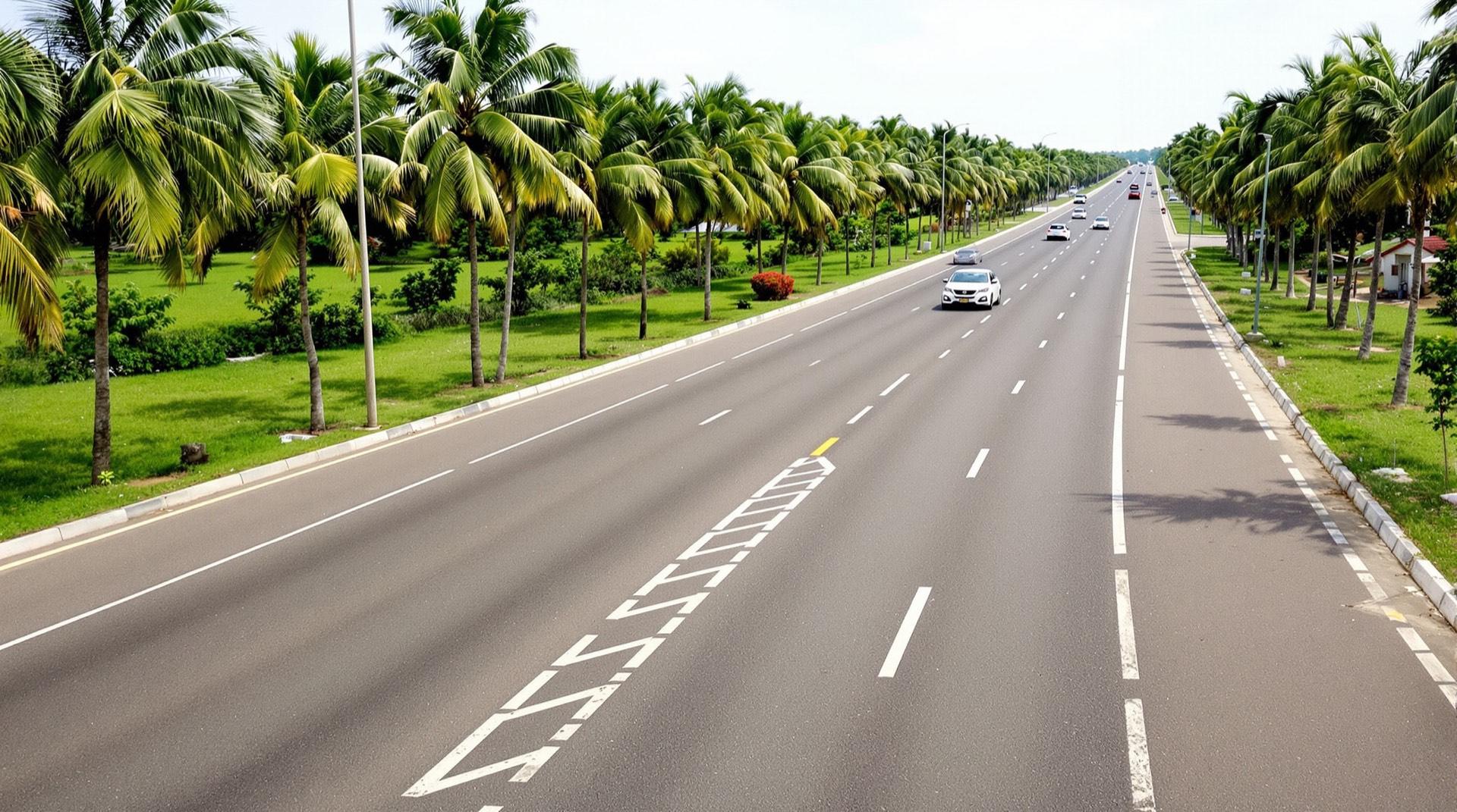
Artist's impression: a dual carriageway lined with palms, running through green countryside

Obafemi-Owode, Ogun State

Iro, on the Papalanto–Sagamu Road.

Between the Lagos–Abeokuta and Lagos–Ibadan expressways, not on either.

The land

Exactly as the survey plan shows it.

Part A, the first town, drawn from its provisional survey plan.
Area
411.48 hectares (1,017.02 acres, as stated on the plan)
Survey plan
OG/1089/2026/PROV.015 (provisional)
Frontage
≈ 1.7 km of frontage on the Papalanto–Sagamu Road (northern boundary)
Part A · 1,017.02 acres · outline from provisional survey plan, not to scaleAn illustrated outline of Part A of The Ridge City. The northern boundary runs about 1.7 km along the Papalanto–Sagamu Road, towards Papalanto in the west and Sagamu in the east. An existing road runs along the eastern boundary. The gate point used for distances sits on the frontage road.PAPALANTO–SAGAMU ROAD← PAPALANTOSAGAMU →EXISTING ROAD≈ 1.7 KM FRONTAGEPart A1,017.02 acres411.48 hectaresGATE POINT (APPROX.)NOUTLINE FROM PROVISIONAL SURVEY PLAN · NOT TO SCALE

Outline from provisional survey plan OG/1089/2026/PROV.015, not to scale. An illustration, not a plot layout.

See it on the map
Pin: our frontage on the Papalanto–Sagamu Road, Iro. Map positions are converted from the plan's UTM grid and are approximate (± about 200 m). Map data © OpenStreetMap contributors.View larger map(opens OpenStreetMap in a new tab)
Full survey details
Surveyor
Surv. Oluyemi Adewale Adekanbi, Registered Surveyor (SURCON Reg. No. 1089) · Digital Globe Survey Geo-Solution Concept, Abeokuta
Plan date
28 August 2026 (certified true copy of the provisional plan)
Prepared for
Pertinence Properties Limited
Location
Along Papalanto–Sagamu Road, Iro Town, Obafemi-Owode LGA, Ogun State
Boundaries
An existing road runs along the eastern boundary.
Grid
UTM Zone 31 · north-east beacon ≈ 540 579.803 mE / 760 234.496 mN
Part B
Part B (about 983 acres) is proposed: not yet secured, surveyed or titled.
Title status
Deed of assignment in place; provisional survey plan (OG/1089/2026/PROV.015) for Part A completed by a SURCON-registered surveyor; Certificate of Occupancy (C of O) application in process. Title & documents

Getting there

How far it really is.

Measured by road from our frontage, for the trips buyers ask about first.
Drive-time rings from The Ridge CityConcentric rings at 10, 20, 30, 45, 60 and 90 minutes' off-peak drive from the site frontage at Iro. 6 places within 10 minutes, 12 places within 20 minutes, 23 places within 30 minutes, 67 places within 45 minutes, 127 places within 60 minutes, 154 places within 90 minutes. Each dot is a measured place at its compass bearing; Abeokuta lies north, Lagos south, Sagamu east and Papalanto west.Mokoloki — 5 min, ≈ 3.4 km by road (off-peak)Eleworo — 7 min, ≈ 5.1 km by road (off-peak)Acuity Microfinance Bank — 12 min, ≈ 6.6 km by road (off-peak)Solid Foundation International School, Ofada — 14 min, ≈ 13 km by road (off-peak)Trinity International College, Ofada — 15 min, ≈ 11 km by road (off-peak)Lantos Specialist Hospital — 17 min, ≈ 8.8 km by road (off-peak)MedicPlus Hospital, Mowe — 18 min, ≈ 16 km by road (off-peak)Mowe Main Market — 22 min, ≈ 20 km by road (off-peak)Upper Room Baptist Church Camp Ground — 27 min, ≈ 23 km by road (off-peak)Rainbow College, Ibafo — 28 min, ≈ 28 km by road (off-peak)Baptist International Convention Centre — 29 min, ≈ 21 km by road (off-peak)Redeemer's College of Technology and Management — 29 min, ≈ 25 km by road (off-peak)Canaan Land Market (Redemption City) — 30 min, ≈ 23 km by road (off-peak)Papalanto (Papa Alanto) — 32 min, ≈ 20 km by road (off-peak)Sagamu Market — 32 min, ≈ 30 km by road (off-peak)Pentecostal City Camp Ground (Km 52) — 33 min, ≈ 23 km by road (off-peak)Police Station, Warewa — 33 min, ≈ 34 km by road (off-peak)Ewekoro — 34 min, ≈ 23 km by road (off-peak)Ibafo — 34 min, ≈ 34 km by road (off-peak)Ayotola Specialist Hospital, Sagamu — 35 min, ≈ 34 km by road (off-peak)TCN 132/33 kV Substation, Sagamu — 35 min, ≈ 35 km by road (off-peak)30 MW Independent Power Plant, Onijanganjangan (Ewekoro) — 36 min, ≈ 24 km by road (off-peak)Arigbajo Market — 36 min, ≈ 25 km by road (off-peak)General Hospital Itori — 37 min, ≈ 27 km by road (off-peak)Federal Government Girls College, Sagamu — 37 min, ≈ 36 km by road (off-peak)Kara Market (Lagos–Ibadan Expressway) — 37 min, ≈ 40 km by road (off-peak)Ojodu Berger Interchange — 37 min, ≈ 41 km by road (off-peak)Ifo General Hospital — 38 min, ≈ 28 km by road (off-peak)Owode stalls market, Owode Egba — 38 min, ≈ 37 km by road (off-peak)Ilishan-Remo — 41 min, ≈ 42 km by road (off-peak)Day Waterman College — 42 min, ≈ 44 km by road (off-peak)Celplas Industries Free Trade Zone, Sagamu axis — 43 min, ≈ 44 km by road (off-peak)The Rack Centre, Ikeja — 43 min, ≈ 47 km by road (off-peak)Ikeja Golf Course — 45 min, ≈ 50 km by road (off-peak)Lagos Marriott Hotel Ikeja — 46 min, ≈ 49 km by road (off-peak)Reddington Hospital, Ikeja GRA — 46 min, ≈ 50 km by road (off-peak)Babatunde Fashola SGR Station, Agege — 47 min, ≈ 48 km by road (off-peak)Ikeja Cantonment (Nigerian Army) — 47 min, ≈ 52 km by road (off-peak)Iju Water Works — 50 min, ≈ 51 km by road (off-peak)Airport Interchange (Ikeja) — 50 min, ≈ 56 km by road (off-peak)Ota Market — 51 min, ≈ 45 km by road (off-peak)Ota — 51 min, ≈ 46 km by road (off-peak)Promasidor Nigeria factory — 51 min, ≈ 58 km by road (off-peak)Olabisi Onabanjo University, Ibogun Campus — 52 min, ≈ 37 km by road (off-peak)Remo Economic Industrial Cluster (by Gateway Airport) — 53 min, ≈ 47 km by road (off-peak)McPherson University, Seriki Sotayo — 54 min, ≈ 62 km by road (off-peak)Marina Station (Lagos Blue Line) — 54 min, ≈ 66 km by road (off-peak)Fara Hotel and Suites — 56 min, ≈ 49 km by road (off-peak)Okearo Substation — 56 min, ≈ 54 km by road (off-peak)Paras Energy power plant (96 MW gas) — 56 min, ≈ 54 km by road (off-peak)Green Legacy Resort, Abeokuta — 56 min, ≈ 63 km by road (off-peak)Ikoyi Club Golf Course — 56 min, ≈ 67 km by road (off-peak)Ravella Hotel & Suites — 57 min, ≈ 51 km by road (off-peak)Bells University of Technology, Ota — 57 min, ≈ 51 km by road (off-peak)Obasanjo Farms, Ota — 58 min, ≈ 49 km by road (off-peak)Ibara Central Mosque, Abeokuta — 58 min, ≈ 67 km by road (off-peak)Kuti Heritage Museum, Abeokuta — 58 min, ≈ 67 km by road (off-peak)Tai Solarin University of Education, Ijagun — 58 min, ≈ 68 km by road (off-peak)National Museum, Abeokuta — 59 min, ≈ 67 km by road (off-peak)Ogun State Fire Service, Abeokuta — 60 min, ≈ 68 km by road (off-peak)Cathedral Church of St. Peter, Ake (Abeokuta) — 60 min, ≈ 70 km by road (off-peak)Patterson Zochonis (PZ) factory, Ikorodu axis — 63 min, ≈ 43 km by road (off-peak)Moshood Abiola Polytechnic (MAPOLY), Abeokuta — 64 min, ≈ 53 km by road (off-peak)Covenant University Guest House, Ota — 64 min, ≈ 54 km by road (off-peak)Neuropsychiatric Hospital, Aro (Abeokuta) — 65 min, ≈ 56 km by road (off-peak)Chrisland University, Abeokuta — 66 min, ≈ 67 km by road (off-peak)Ogun-Osun Dam reservoir — 76 min, ≈ 80 km by road (off-peak)Lagos Business School, Lekki — 76 min, ≈ 92 km by road (off-peak)Novare Lekki Mall, Sangotedo — 80 min, ≈ 96 km by road (off-peak)Lufasi Nature Park — 81 min, ≈ 98 km by road (off-peak)Lekki–Epe International Airport (proposed site) — 88 min, ≈ 102 km by road (off-peak)Iro (host community) — 2 min, ≈ 1.1 km by road (off-peak)Mokoloki solar mini-grid (185 kW) — 5 min, ≈ 3.4 km by road (off-peak)Olorunsogo I power station (gas, ≈ 335 MW) — 8 min, ≈ 5.2 km by road (off-peak)Olorunsogo II power station (NDPHC, gas, ≈ 675–750 MW nameplate) — 10 min, ≈ 5.2 km by road (off-peak)Ofada town & Ofada rice — 14 min, ≈ 12 km by road (off-peak)Christopher University, Mowe — 22 min, ≈ 20 km by road (off-peak)Mowe — 27 min, ≈ 25 km by road (off-peak)NASFAT Islamic Centre, Asese — 28 min, ≈ 25 km by road (off-peak)Redemption City (RCCG), Km 46, Lagos–Ibadan Expressway — 29 min, ≈ 23 km by road (off-peak)Mountain Top University, Makogi-Oba — 30 min, ≈ 29 km by road (off-peak)MFM Prayer City, Magboro — 31 min, ≈ 30 km by road (off-peak)Lagos–Abeokuta Expressway (A5) near Papalanto — 32 min, ≈ 20 km by road (off-peak)Deeper Life International Conference Centre (Km 42) — 33 min, ≈ 24 km by road (off-peak)Lagos–Ibadan Expressway at Mowe (via Ofada–Mowe Road) — 33 min, ≈ 24 km by road (off-peak)Nestlé Flowergate Factory, Sagamu — 33 min, ≈ 32 km by road (off-peak)Sagamu Interchange — 33 min, ≈ 32 km by road (off-peak)Hi-Impact Planet amusement park — 34 min, ≈ 33 km by road (off-peak)Coleman Wires & Cables complex, Sagamu — 35 min, ≈ 34 km by road (off-peak)Sagamu & the Remo Kingdom — 35 min, ≈ 34 km by road (off-peak)Olabisi Onabanjo University Teaching Hospital (OOUTH), Sagamu — 36 min, ≈ 35 km by road (off-peak)Ifo — 38 min, ≈ 28 km by road (off-peak)Obafemi Owode Local Government (secretariat site), Owode Egba — 38 min, ≈ 37 km by road (off-peak)Iperu (Sagamu–Iperu–Ode Remo & Ilishan–Iperu roads) — 38 min, ≈ 38 km by road (off-peak)Kajola SGR Station (Yemi Osinbajo) — 40 min, ≈ 24 km by road (off-peak)New Afrika Shrine, Ikeja — 41 min, ≈ 45 km by road (off-peak)Babcock University Teaching Hospital, Ilishan-Remo — 42 min, ≈ 44 km by road (off-peak)Babcock University, Ilishan-Remo — 42 min, ≈ 44 km by road (off-peak)Ikeja (Lagos State capital) — 42 min, ≈ 47 km by road (off-peak)Papalanto SGR Station (Funmilayo Ransome-Kuti) — 43 min, ≈ 28 km by road (off-peak)Cadbury Nigeria factory, Ikeja — 43 min, ≈ 45 km by road (off-peak)Agege Stadium — 45 min, ≈ 47 km by road (off-peak)Lagos State University Teaching Hospital (LASUTH), Ikeja — 45 min, ≈ 49 km by road (off-peak)Ikeja Red Line Station — 45 min, ≈ 51 km by road (off-peak)Hyatt Regency Lagos Ikeja — 47 min, ≈ 50 km by road (off-peak)Murtala Muhammed International Airport (LOS), Ikeja — 49 min, ≈ 54 km by road (off-peak)National Orthopaedic Hospital, Igbobi — 49 min, ≈ 58 km by road (off-peak)The Palms Mall, Ota — 51 min, ≈ 45 km by road (off-peak)Yaba College of Technology — 51 min, ≈ 57 km by road (off-peak)Ladipo Market, Mushin — 51 min, ≈ 57 km by road (off-peak)Lagos University Teaching Hospital (LUTH), Idi-Araba — 51 min, ≈ 59 km by road (off-peak)Legend Hotel Lagos Airport (Curio Collection by Hilton) — 52 min, ≈ 54 km by road (off-peak)National Stadium, Surulere — 52 min, ≈ 59 km by road (off-peak)Gateway International Agro-Cargo Airport (GWI), Ilishan/Iperu-Remo — 53 min, ≈ 47 km by road (off-peak)Mobolaji Johnson SGR Terminus, Ebute Metta — 53 min, ≈ 59 km by road (off-peak)University of Lagos (UNILAG), Akoka — 53 min, ≈ 60 km by road (off-peak)Ikorodu — 54 min, ≈ 64 km by road (off-peak)Apapa Port (Lagos Port Complex) — 54 min, ≈ 64 km by road (off-peak)Cathedral Church of Christ, Marina — 54 min, ≈ 65 km by road (off-peak)Lagos Central Mosque — 55 min, ≈ 64 km by road (off-peak)Lagos Island (Marina) — 55 min, ≈ 64 km by road (off-peak)Tinubu Square, Lagos Island — 55 min, ≈ 65 km by road (off-peak)City Mall, Onikan (Lagos Island) — 55 min, ≈ 66 km by road (off-peak)National Museum, Onikan (Lagos) — 55 min, ≈ 67 km by road (off-peak)Agbado — SGR (Lateef Jakande Station) & Lagos Red Line terminus — 56 min, ≈ 53 km by road (off-peak)MKO Abiola Stadium, Abeokuta — 56 min, ≈ 65 km by road (off-peak)Park Inn by Radisson, Abeokuta — 56 min, ≈ 65 km by road (off-peak)Freedom Park, Lagos Island — 56 min, ≈ 66 km by road (off-peak)St Nicholas Hospital, Lagos Island — 56 min, ≈ 66 km by road (off-peak)Office of the Surveyor-General, Ogun State (Abeokuta) — 57 min, ≈ 66 km by road (off-peak)Federal Palace Hotel & Casino, Victoria Island — 57 min, ≈ 68 km by road (off-peak)Ijebu-Ode — 58 min, ≈ 68 km by road (off-peak)Prof. Wole Soyinka SGR Station, Abeokuta (Laderin) — 59 min, ≈ 63 km by road (off-peak)Eko Atlantic City — 59 min, ≈ 71 km by road (off-peak)Victoria Island — 59 min, ≈ 72 km by road (off-peak)Federal Medical Centre, Abeokuta — 60 min, ≈ 69 km by road (off-peak)Abeokuta (Ogun State capital) — 60 min, ≈ 69 km by road (off-peak)Federal Polytechnic Ilaro — 61 min, ≈ 45 km by road (off-peak)Canaanland, Ota — 61 min, ≈ 54 km by road (off-peak)Sungbo's Eredo earthworks — 61 min, ≈ 66 km by road (off-peak)Lagos State University of Science & Technology (former LASPOTECH), Ikorodu — 61 min, ≈ 68 km by road (off-peak)Ake Palace (Alake of Egbaland) & Centenary Hall, Abeokuta — 61 min, ≈ 70 km by road (off-peak)Olumo Rock, Abeokuta — 62 min, ≈ 70 km by road (off-peak)Otunba Dipo Dina International Stadium, Ijebu-Ode — 62 min, ≈ 71 km by road (off-peak)Lekki Phase 1 — 63 min, ≈ 74 km by road (off-peak)Covenant University, Ota — 65 min, ≈ 55 km by road (off-peak)Olabisi Onabanjo University, Ago-Iwoye — 68 min, ≈ 65 km by road (off-peak)Lagos State University (LASU), Ojo — 68 min, ≈ 75 km by road (off-peak)Dangote Cement Factory, Ibese — 70 min, ≈ 54 km by road (off-peak)Lekki Conservation Centre — 72 min, ≈ 84 km by road (off-peak)Egbin Thermal Power Station — 75 min, ≈ 81 km by road (off-peak)Ibadan (city centre) — 78 min, ≈ 98 km by road (off-peak)Epe — 84 min, ≈ 96 km by road (off-peak)Federal University of Agriculture, Abeokuta (FUNAAB) — 86 min, ≈ 84 km by road (off-peak)10′20′30′45′60′90′ABEOKUTALAGOSSAGAMUPAPALANTO
Each dot is a measured place, placed by off-peak drive time from our frontage. Gold dots are the better-known places; hover a dot for its name.
Lagos–Ibadan Expressway, at Mowe
≈ 33 min≈ 24 km
Gateway Airport, Iperu
42–53 min≈ 45 km
Lagos international airport
≈ 49 min≈ 54 km
Lagos Island (Marina)
≈ 55 min≈ 64 km

Off-peak estimates from our frontage at Iro. Rush hour is slower. OSRM, 23 Oct 2026.

All drive times

Key trips, nearest first

  1. Olorunsogo power stations

    8–10 min · ≈ 5.2 km

  2. Ofada town

    ≈ 14 min · ≈ 12 km

  3. Christopher University, Mowe

    ≈ 22 min · ≈ 20 km

  4. Redemption City

    25–30 min · ≈ 20–22 km

  5. Lagos–Abeokuta Expwy (Papalanto)

    ≈ 32 min · ≈ 20 km

  6. Lagos–Ibadan Expwy (Mowe)

    ≈ 33 min · ≈ 24 km

  7. OOUTH teaching hospital, Sagamu

    ≈ 36 min · ≈ 35 km

  8. Kajola rail station

    ≈ 40 min · ≈ 24 km

  9. Babcock University

    ≈ 42 min · ≈ 44 km

  10. Lagos international airport (MMIA)

    ≈ 49 min · ≈ 54 km

  11. Gateway Airport, Iperu

    42–53 min · ≈ 45 km

  12. Lagos Island (Marina)

    ≈ 55 min · ≈ 64 km

  13. Lekki Phase 1

    ≈ 63 min · ≈ 74 km

Off-peak (free-flow) estimates by road from our frontage at Iro, OSRM, 23 Oct 2026. Rush hour, road works and event days at the faith camps can make journeys much longer: we never promise a fixed time to Lagos.

How many places sit within each drive time

  1. 6 places

    Within 10 minutes

    power & utilities 3 · towns & cities 3

  2. 12 places

    Within 20 minutes

    power & utilities 3 · towns & cities 3 · education 2

  3. 23 places

    Within 30 minutes

    education 6 · faith 4 · towns & cities 4

  4. 67 places

    Within 45 minutes

    towns & cities 10 · education 9 · health 8

  5. 127 places

    Within 60 minutes

    towns & cities 17 · education 15 · health 13

  6. 154 places

    Within 90 minutes

    education 24 · towns & cities 20 · health 14

Counts are cumulative, from 157 places measured. Kept only for comparison, beyond 90 minutes: Ibeju-Lekki (92 min) · Lekki Deep Sea Port (111 min) · Dangote Petroleum Refinery, Lekki FTZ (118 min).

The corridor map
Where the land sits — schematic, not to scaleThe Ridge City sits at Iro on the Papalanto–Sagamu Road, the road that links the Lagos–Abeokuta Expressway at Papalanto (about 20 km west by road) with the Lagos–Ibadan Expressway at the Sagamu Interchange (about 32–36 km east). The Olorunsogo power stations are about 5 km west on the same road. Ofada is about 12 km away and the Lagos–Ibadan Expressway at Mowe about 24 km, with Redemption City about 20–22 km and Magboro (MFM Prayer City, Mountain Top University) about 30 km. Sagamu, with OOUTH and its industry, lies east of the interchange, and Gateway Airport about 45 km to the east, beyond Sagamu. Lagos lies to the south (airport about 54 km, Lagos Island about 64 km) and Abeokuta to the north (about 69 km). The Lagos–Ibadan railway runs to the west, with stations at Kajola (about 24 km) and Papalanto. All distances are off-peak road estimates.Papalanto≈ 20 kmOlorunsogopower stations · ≈ 5 kmOfada≈ 12 kmMoweL–I Expwy ≈ 24 kmRedemption City≈ 20–22 kmMagboro · ≈ 30 kmMFM · Mountain TopSagamu Interchange≈ 32–36 kmSagamuOOUTH · industryGateway Airport≈ 45 kmAbeokuta≈ 69 kmKajolarail · ≈ 24 kmLagosAirport ≈ 54 km · Island ≈ 64 kmTo IbadanRail to IbadanTo BeninThe Ridge CityIRO · PAPALANTO–SAGAMU ROADN
Schematic, not to scale. Distances are approximate off-peak road estimates from our frontage at Iro (OSRM, 23 Oct 2026). Swipe to see the whole area
  • Papalanto–Sagamu RoadOur ≈ 1.7 km frontage — concrete rebuild, works ongoing; closed for reconstruction as of Jan 2026
  • ExpresswaysLagos–Abeokuta via Papalanto · Lagos–Ibadan via Ofada and Mowe
  • Local roadsOfada–Mowe road, Sagamu and Remo links
  • Lagos–Ibadan railwayStations at Kajola (≈ 24 km) and Papalanto (≈ 28 km)
  • The Ridge City, Part AIro Town, Obafemi-Owode LGA
  • Faith
  • Education
  • Health
  • Industry & jobs
  • Power
Trade-offs, honestly

Every location has trade-offs. Here are ours, and what we do, or plan to do, about each.

  • Commute traffic and road works

    The honest risk

    Trips to Lagos use the Lagos–Ibadan Expressway (via Ofada and Mowe) or the Lagos–Abeokuta Expressway (via Papalanto). Both can gridlock at rush hour, after crashes and on big event days at the faith camps; the Ibadan-bound stretch of the Lagos–Ibadan was declared 'failing' in June 2026, and our own frontage road was closed for reconstruction in January 2026.

    Our answer

    The Ridge City is planned so daily life doesn't depend on the commute: jobs, schools, healthcare and shopping inside the city, plus planned shuttles to the expressways and rail. We always quote off-peak times as off-peak and never promise a fixed time to Lagos.

  • Public projects can slip

    The honest risk

    Government projects in the area have run late: the Lagos–Ibadan Expressway reconstruction began in 2013, the Mowe–Ofada road's second section is unfinished, the Papalanto–Sagamu rebuild — targeted at 70% by December 2025 — stood at about 25 of about 40 km in January 2026, and the Red Line extension into Ogun is only under discussion.

    Our answer

    We label every outside project Operational, Works ongoing or Proposed, with its source and date — and our prices don't assume anything unbuilt. The city's own infrastructure is planned in phases, and we'll report it publicly with dated progress and drone updates.

  • Possible tolls

    The honest risk

    In June 2026 the Federal Executive Council approved a private concession for the expressway. Toll terms are not public yet, and tolls could raise the cost of commuting.

    Our answer

    On-site jobs and services reduce how often residents need the expressway, and the Lagos–Abeokuta Expressway via Papalanto and the Sagamu–Ikorodu road offer other routes into Lagos.

  • A young airport

    The honest risk

    Gateway Airport is new: it began on an interim operating permit, its schedules are still growing, and its only international flights so far are Hajj charters.

    Our answer

    We describe it as 'commissioned and growing' and never imply scheduled international flights. Lagos's international airport remains about 54 km away (about 49 minutes off-peak).

  • Limited rail service

    The honest risk

    The Lagos–Ibadan railway runs a limited passenger timetable. Its nearest stations, Kajola and Papalanto, are about 24–28 km away by road, and we have not confirmed which trains stop there.

    Our answer

    We present rail as a complement to the road, not a daily commute, and plan shuttle links to the nearest stations.

  • Uneven regional healthcare

    The honest risk

    Quality varies across the region's hospitals — in 2019 Ogun's governor described the state teaching hospital as 'worse than deplorable'.

    Our answer

    Ridge Health is planned inside the city — a maternity and children's hospital, a specialist hospital and diagnostics — and we're seeking reputable operators as partners.

  • Title defects and land disputes

    The honest risk

    Buyers in Ogun worry about government acquisition, family-land disputes (omo onile) and slow title processing. Lagos registry searches don't cover Ogun land.

    Our answer

    We publish our exact title status — "Deed of assignment in place; provisional survey plan (OG/1089/2026/PROV.015) for Part A completed by a SURCON-registered surveyor; Certificate of Occupancy (C of O) application in process." — and a document roadmap you can track in your portal. We encourage independent searches at the Ogun State Bureau of Lands and Survey and will share copies of our documents with your lawyer.

Sources

Distances and drive times are approximate road estimates from the site frontage on the Papalanto–Sagamu Road at Iro (a gate point converted from the provisional survey plan, ± about 200 m): off-peak free-flow estimates, OSRM, 23 Oct 2026. Rush-hour, road-works and event-day journeys take longer, and parts of the Papalanto–Sagamu road were closed for reconstruction in January 2026.
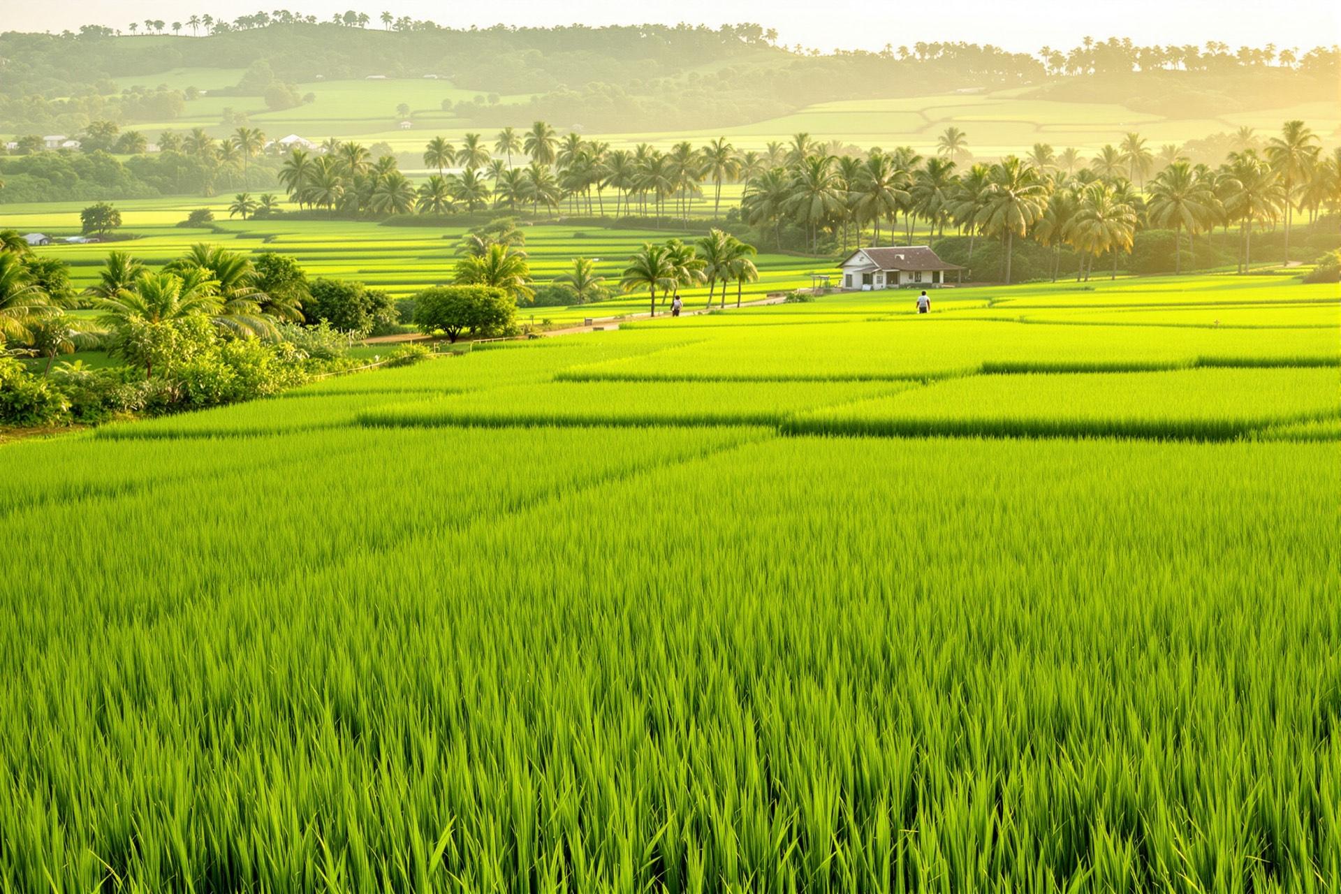
Artist's impression: green rice paddies stretching to palm trees and low hills

Nearby

157 places, measured from our frontage.

Towns, schools, hospitals, markets, faith centres and industry, each measured by road.
Browse all 157 places

Within (off-peak drive)

Category

157places — showing 24

Places come from OpenStreetMap and Wikidata; points marked “approx.” are placed at village, town, campus or area level. Inclusion is not an endorsement by, or affiliation with, any place listed.

The landmarks that matter

Each carries its status, its sources and how sure we are. Operational means open today; works ongoing, designated and proposed mean exactly that.

Showing 9 of 33 places.

  • Transport

    Works ongoing

    Papalanto–Sagamu Road (our frontage)

    Frontage · ≈ 1.7 km along the northern boundary

    The land has about 1.7 km of frontage on the road that links the Lagos–Abeokuta Expressway at Papalanto with the Lagos–Ibadan Expressway at the Sagamu Interchange. We report the rebuild as works ongoing — we don't claim the stretch along our frontage is finished.

    Status: Being rebuilt as a concrete dual carriageway under an Ogun State / Federal Government / Dangote partnership. In January 2026 the governor said about 25 of the roughly 40 km between Sagamu Interchange and Papalanto had been rebuilt, and the road was closed for reconstruction.

    Closed for reconstruction as of January 2026 (ThisDay). Which stretches are finished has not been confirmed.

    Key facts
    • Part of the 100 km Obele–Ilaro–Papalanto–Shagamu road approved by the Federal Executive Council in July 2021 at about ₦80bn under the Dangote road tax-credit scheme (Ripples / Daily Trust, 15 Jul 2021).
    • About 25 of about 40 km rebuilt in reinforced concrete, the governor said in January 2026 (ThisDay, 21 Jan 2026).
    ReportedReported by credible sources; details may change.Sources1234
  • Transport

    Operational

    Murtala Muhammed International Airport, Lagos

    ≈ 54 km · 49 min (off-peak)

    Land from London, Houston or Toronto and reach the city in under an hour off-peak. Lagos peak-hour traffic takes much longer, so plan arrivals accordingly.

    Status: Operational — Nigeria's main international gateway.

    ReportedReported by credible sources; details may change.Sources12
  • Transport

    Commissioned

    Gateway International Agro-Cargo Airport, Ilishan/Iperu-Remo

    ≈ 45 km · 42–53 min (off-peak)

    Ogun's own airport — an alternative gateway for visitors from Abuja and the North, and a cargo base for the agro-processing and logistics businesses Ridge Works is planned for.

    Status: Scheduled domestic flights since 7 October 2025; commissioned on 4 April 2026; Hajj flights to Jeddah in May 2026. Hajj charters are its only international flights so far.

    No scheduled international passenger service. Hajj charters only so far.

    Key facts
    • Runway of about 4 km, described by a NAMA official as the longest in the country.
    • Interim aerodrome operational permit granted by the NCAA in August 2025.
    • Drive time depends on the terminal access point: about 42 min to one point, 53 min to the aerodrome centre.
    Well sourcedConfirmed by primary or multiple independent sources.Sources12345
  • Industry & jobs

    Partly operational

    Olorunsogo gas power stations (I and II)

    ≈ 5.2 km · 8–10 min (off-peak)

    Two large gas power stations about 5 km west, on our frontage road — a sign of the area's industrial role. Their capacity is nameplate, not a promise of power to the city; The Ridge City plans its own hybrid solar + gas supply.

    Status: Olorunsogo I (about 335 MW) and Olorunsogo II (NDPHC, about 675–750 MW nameplate, commissioned February 2015) are partially operational and limited by gas supply.

    Nameplate capacity, not a supply promise.

    ReportedReported by credible sources; details may change.Sources12345
  • Faith

    Operational

    Redemption City (RCCG), Mowe

    ≈ 20–22 km · 25–30 min (off-peak)

    Proof, about 20 km away, that a privately run city with its own power and water can work in this part of Ogun — and a year-round source of visitors for hotels, short-lets and restaurants.

    Status: Operational and expanding. Renamed Redemption City in August 2022.

    The Ridge City is independent and is not affiliated with, or endorsed by, RCCG. Range reflects two points inside the camp.

    Key facts
    • More than 2,000 hectares (Wikipedia gives about 2,500 ha).
    • Runs its own gas power station — 25 MW by the church's account.
    • More than 10 schools and colleges, banks, markets and its own security and fire services (The Sun, 2023).
    ReportedReported by credible sources; details may change.Sources123
  • Education

    Operational

    Christopher University, Mowe

    ≈ 20 km · 22 min (off-peak)

    A university about 20 minutes away off-peak — part of the cradle-to-legacy promise, and a source of student and staff housing demand.

    Status: Operational. Reported fully accredited by New Telegraph in May 2025.

    Key facts
    • Address: Km 34, Lagos–Ibadan Expressway, Mowe.
    ReportedReported by credible sources; details may change.Sources123
  • Health

    Operational

    Olabisi Onabanjo University Teaching Hospital (OOUTH), Sagamu

    ≈ 35 km · 36 min (off-peak)

    Tertiary care about 35 minutes away off-peak. Quality across the region is uneven — which is exactly why Ridge Health is planned inside the city.

    Status: Operational; new facilities reported (UNICEF-supported oxygen plant 2023, RCCG-donated dialysis centre 2021).

    ReportedReported by credible sources; details may change.Sources123
  • Heritage

    Current

    Ofada town & Ofada rice

    ≈ 12 km · 14 min (off-peak)

    Ofada rice — aromatic, unpolished, premium-priced and served at upscale Nigerian celebrations — takes its name from Ofada town, about 12 km away by road. The planned Agri-Park keeps that heritage growing.

    Status: Cultivation ongoing in Obafemi Owode.

    Well sourcedConfirmed by primary or multiple independent sources.Sources123
  • Policy

    Current

    Ogun: 5th in Nigeria for ease of doing business (PEBEC 2025)

    Statewide

    A competitive state to build and do business in. Fifth, not first — and we'd rather tell you that than overclaim.

    Status: PEBEC Subnational Ease of Doing Business report, December 2025: Ogun 5th of 37 at 59.9%.

    Well sourcedConfirmed by primary or multiple independent sources.Sources1

Distances and drive times are approximate road estimates from the site frontage on the Papalanto–Sagamu Road at Iro (a gate point converted from the provisional survey plan, ± about 200 m): off-peak free-flow estimates, OSRM, 23 Oct 2026. Rush-hour, road-works and event-day journeys take longer, and parts of the Papalanto–Sagamu road were closed for reconstruction in January 2026.

Visit

Stand on the land before you decide.

Walk the frontage and drive the road yourself. Questions first? Read the location questions.